Advanced 2D Vector Graphics for Architectural Presentations
At All Architecture Illustrations, we craft impressive 2D vector maps that blend technical precision with aesthetic clarity. Whether you need detailed site plans, city layouts, or architectural blueprints, our 2D vector illustration services offer outputs tailored to your project needs. Designed using advanced 2D vector graphics, our maps are ideal for architectural presentations, GIS mapping, and real estate visualization helping professionals communicate spatial information with unmatched accuracy and style.
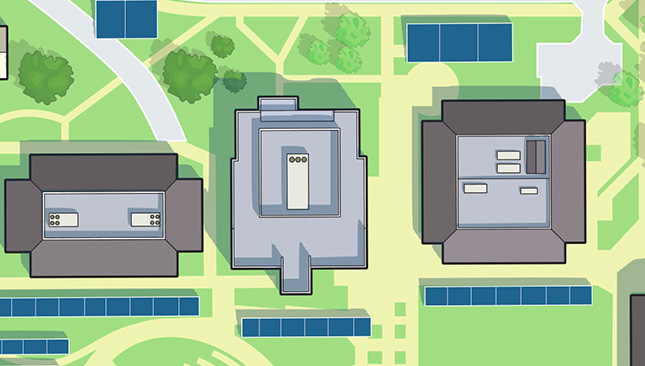
Impressive 2D Vector Map for Project
Welcome to All Architecture Illustrations, where we specialize in creating high-quality, precise, and visually compelling 2D vector maps for architects, developers, real estate firms, urban planners, and design studios worldwide.
.jpg)
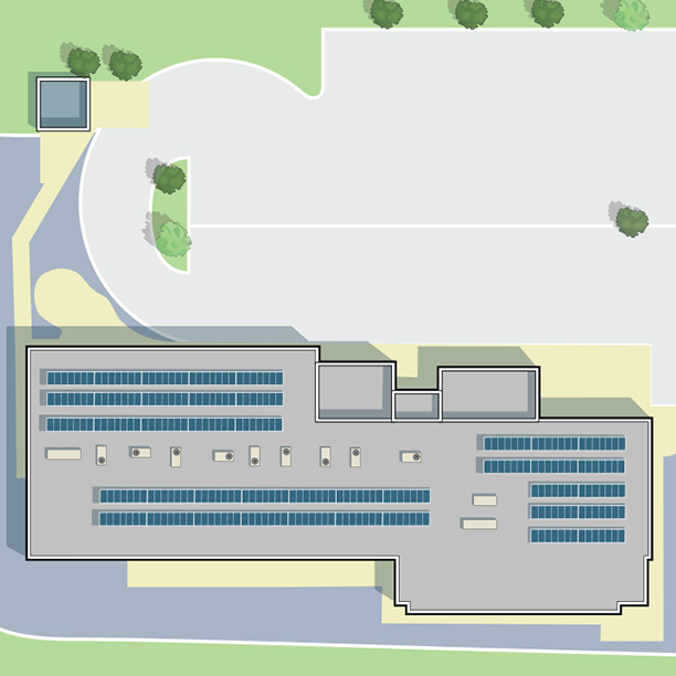
What is a 2D Vector Map?
A 2D vector map is a simplified, flat representation of a physical space, such as a building layout, urban area, or topographical design. This makes them ideal for technical drawings, floor plans, architectural presentations, and GIS projects.
Why Choose Our 2D Vector Map Service?
At All Architecture Illustrations, we pride ourselves on combining artistic accuracy with architectural precision. Whether you're looking for a minimalist 2D vector illustration of a city block or a detailed 2D vector map of a commercial property, our experienced team ensures that every line, shape, and layer is tailored to your specifications.
- High Resolution and Scalability
- Editable and Layered Source Files
- Consistent Line Work and Color Schemes
- Custom Legends, Labels, and Annotations
- Quick Turnaround Time
- Compatible Formats: AI, SVG, DWG, PDF, DXF
Benefits of Our 2D Vector Graphics Services
Our 2D Vector Illustration Services Include
Architectural 2D Vector Map Design
We create clear and precise 2D vector maps of buildings, campuses, and infrastructure projects.
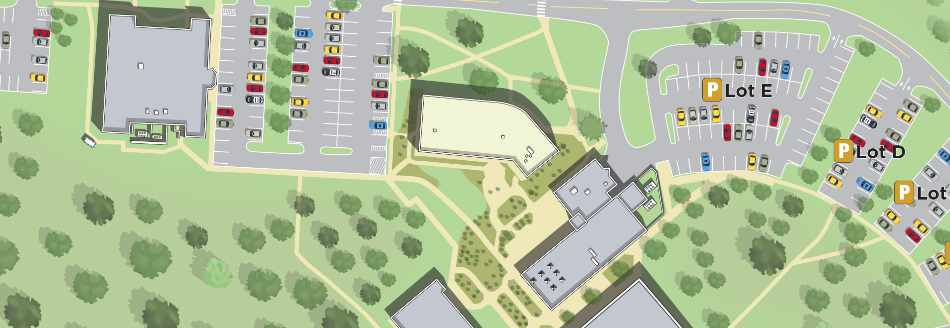
Urban and City 2D Vector Graphics
Need a custom 2D vector illustration of a city layout or zoning plan? Our urban mapping experts can convert aerial imagery or hand-drawn sketches into detailed 2D vector graphics.
Topographical and Land Use Maps
We translate elevation data and land use layouts into intuitive, readable 2D vector illustrations, using color-coding and symbols for clarity.
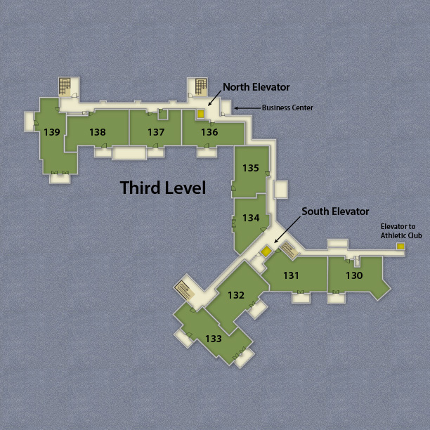
Interior Layouts and Floor Plans
From residential blueprints to commercial interiors, our team crafts functional 2D vector graphics that communicate structure and design effortlessly.
What Sets Our 2D Vector Map Service Apart?
Architectural Precision – Every 2D vector map is created with your architectural goals in mind. We understand CAD layers, zoning regulations, and industry standards.
Collaboration-Friendly – Our layered 2D vector graphics allow for easy edits, making teamwork and client approvals seamless.
How It Works
Submit Your Input – Share your sketch, blueprint, image, or idea.
Brief & Scope – We'll confirm your requirements and give you a quote.
Review & Revisions – You’ll get drafts to review, and we'll adjust as needed.
Final Delivery – Receive layered, editable 2D vector graphics in your desired format.
Industry Applications of 2D Vector Maps
Architecture & Construction
Urban Planning & GIS
Real Estate Development
Interior Design & Retail Layouts
Landscape Architecture
Tourism & Event Mapping
Our Tools & Technologies
We work with industry-leading software and platforms to deliver best-in-class 2D vector illustrations:
Adobe Illustrator (AI, EPS, SVG)
AutoCAD (DWG, DXF)
QGIS for mapping accuracy
2D Vector Map Project Showcase
Apartment Complex 2D Vector Maps
Historical District 2D Vector Graphics
Office Floor Plan 2D Vector Illustrations
Festival Site Maps
Retail and Mall Layouts
SEO-Optimized and Brand-Ready
All of our 2D vector graphics can be branded with your logo, color palette, and typography. Plus, they’re SEO-optimized for the web, helping your business stand out in search engines and social media.
Ready to Transform Your Ideas into Scalable 2D Vector Maps?
Your projects deserve more than flat, outdated drawings; they deserve accuracy, clarity, and a design that truly communicates your vision. That’s where our 2D vector map services make all the difference. Whether you’re working on a real estate development, an architectural master plan, or a large-scale city infrastructure project, our team delivers 2D vector illustrations that are professional, scalable, and tailored to your exact needs. We combine creative design skills with technical expertise to ensure every line, curve, and detail in your 2D vector graphics is precise and visually impactful. From zoning maps and layouts to detailed floor plans, we help you present ideas with confidence and consistency.