All Architecture Illustration Expert Mapping & Illustration Services for Every Vision
.jpg)
At All Architecture Illustration, we bring ideas to life through precision, artistry, and modern visualization. Our core services ranging from detailed 2D vector maps to immersive photorealistic maps are crafted for clients who need more than just drawings. We offer clarity, accuracy, and creativity in every project. We specialize in turning complex data and architectural plans into intuitive, visually engaging maps and illustrations. Whether you're a city planner, real estate developer, tourism agency, or architect, our services are tailored to your unique needs. With the support of high end 3D modeling and rendering services we ensure that every visual speaks directly to its audience.
2D Vector
Our 2D vector map services are designed for clarity, accuracy, and scalability. These clean, professional graphics are ideal for architectural presentations, real estate layouts, campus plans, transit maps, and more.
Key Features of Our 2D Vector Maps
- Fully scalable with no loss in quality.
- Ideal for brochures, print, and digital formats.
- Easily editable for updates or customization.
- Suitable for zoning, infrastructure, or development mapping.
Whether youre planning a multi use development or creating educational diagrams, our 2D vector maps simplify complex data into highly readable graphics. Our team uses precision tools and architectural knowledge to ensure every line, label, and icon serves a purpose. When paired with 3D modeling and rendering services, your visuals gain even more depth creating an end to end solution from flat layouts to fully immersive environments.
Read More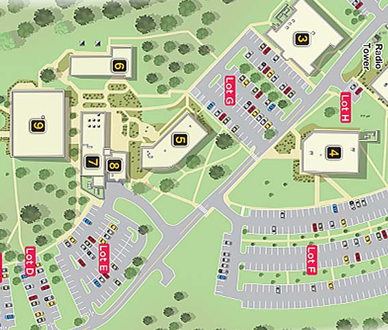
3D Vector Map
Our 3D vector maps provide an interactive and dimensional look at your site, building, or urban area. These are particularly effective for city planning, real estate marketing, construction visualization, and tourism projects.
Advantages of Our 3D Vector Maps
- Clear 3D visualization of buildings, roads, landmarks, and landscapes.
- Easily integrable with CAD drawings or GIS data.
- Excellent for presentations, public consultations, and websites.
- A perfect tool for spatial orientation and context.
Using advanced 3D modeling and rendering services we construct detailed 3D models of terrain, infrastructure, and structures. This results in intuitive maps that offer perspective, scale, and real world relevance ideal for both public communication and technical planning. For clients in architecture and real estate, our 3D building rendering can be layered directly into these maps, showing the proposed structures within their full spatial context.
Read More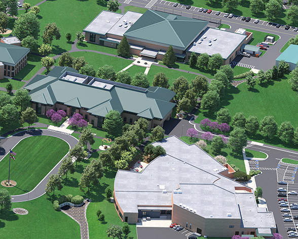
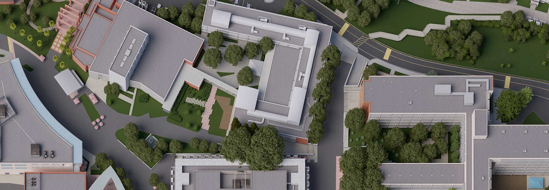
Photorealistic Map
When you want to impress clients, investors, or the public, photorealistic maps are the gold standard. These high-resolution visuals combine realistic lighting, textures, shadows, and detail, giving viewers a near-real-world glimpse of your site or development.
Use Cases Include
- Real estate promotional materials.
- Urban development proposals.
- Resort or campus layouts.
- Concept marketing for future projects.
They can include vehicles, vegetation, signage, pedestrians, and other lifestyle elements to give depth and context to your vision. By leveraging our 3D building rendering capabilities, we incorporate lifelike models of future structures, helping stakeholders envision the outcome. These visuals also serve as excellent tools for VR walkthroughs, presentations, and sales tools, integrating seamlessly with broader 3D modeling and rendering services.
Read More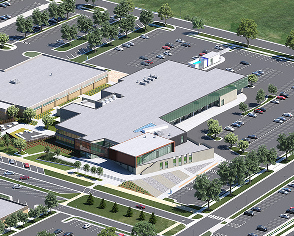
Freehand Illustration
Our freehand illustration service brings back the artistic charm of traditional drawing techniques, paired with the precision of modern planning. These handcrafted illustrations offer a stylized, human touch that s ideal for conceptual designs, historical visuals, or presentations with personality.
Applications of Freehand Illustrations
- Master planning proposals.
- Landscape and garden designs.
- Heritage architecture visuals.
- Sketch-style maps for presentations and books.
These illustrations can be customized to include colored pencil, ink, watercolor effects, or monochrome linework. They are especially effective in early stage design, where creativity and atmosphere are more important than technical precision. Freehand drawings can be the perfect complement to more technical outputs like 3D modeling and rendering services, offering a full spectrum approach that balances emotion and detail.
Read More.jpg)
Location Map
Understanding a place starts with knowing where it sits in context. Our location maps help users identify a site within a broader environment perfect for brochures, websites, city guides, wayfinding systems, or business proposals.
Benefits of Our Location Maps
- Highlight proximity to landmarks, roads, or public transport.
- Great for real estate listings and tourism marketing.
- Easily integrated with branding and promotional content.
- Clear, stylish designs optimized for both digital and print use.
We craft these maps in both 2D and 3D styles based on your needs. By combining spatial analysis with creative layout, we ensure each location map is not just informative, but visually appealing and on-brand. Incorporating 3D building rendering into location maps adds another layer of immersion, letting users understand not just where something is, but what it looks like in relation to its surroundings.
Read More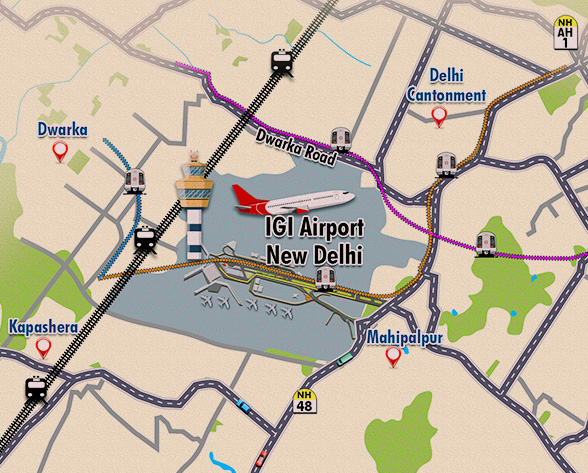
Tourist Map
Tourism thrives on experience, and our tourist map services are built to enhance that journey. Whether you re promoting a heritage site, resort town, or urban destination, we design illustrated maps that guide, entertain, and inform.
Features of Our Tourist Maps
- Illustrated icons of attractions, cafes, hotels, and trails.
- Walking routes, transit lines, and key stops.
- Designed for brochures, signage, and mobile use.
- 3D modeling and rendering services
Our tourist maps are as beautiful as they are functional. They encourage exploration while reinforcing your destinations identity. They re crafted to be user friendly while delivering maximum visual impact. Using our 3D modeling and rendering services, we can create 3D versions of tourist maps for interactive kiosks or digital apps, offering an enhanced experience beyond flat illustrations.
Read More.jpg)