Professional 3d vector maps for
Architecture and Urban Planning
At All Architecture Illustrations, we offer industry-leading 3D vector maps designed to visualize architectural and urban planning concepts with unmatched clarity and detail. Our 3D vector illustration services are tailored for architects, urban designers, developers, and marketing teams who need precise, scalable, and visually compelling 3D map illustrations for presentations, planning, and decision-making.
We don’t just create maps—we build visual narratives that communicate your vision with precision and artistic value.
What Are 3D Vector Maps?
3D vector maps are advanced graphical representations created using vector-based technologies. Unlike pixel-based images, vector illustration uses scalable lines, curves, and shapes, allowing for zooming and editing without any loss of resolution. This makes map illustration ideal for architectural visualization, urban layouts, and infrastructure planning. Our expert designers use tools such as Adobe Illustrator, AutoCAD, SketchUp, and GIS platforms to transform technical data into high-resolution, editable vector maps. These illustrations are perfect for:
3D Vector Illustration Services Tailored to Your Needs

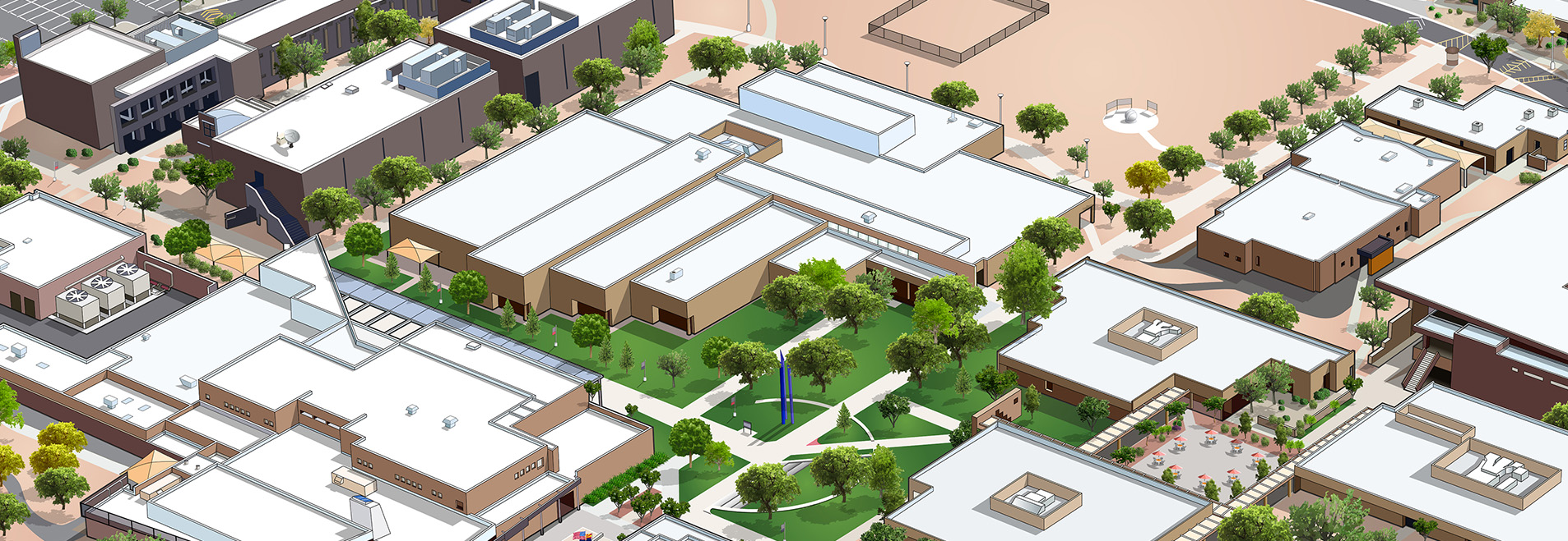
Urban Layouts & City Planning
We design 3D vector maps that represent roads, buildings, public spaces, zoning, and utilities in vibrant detail. Ideal for planners and municipalities.

Masterplans & Site Planning
Our 3D map illustration service transforms large-scale architectural plans into visually rich illustrations that are easy to interpret and present.

Transportation & Infrastructure Mapping
We provide high-quality 3D vector illustrations of highways, rail lines, bridges, airports, and utilities that support both technical and public communication.

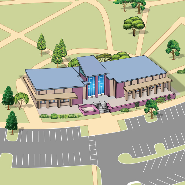
Real Estate Development Visuals
Showcase residential or commercial developments with stunning 3D vector maps highlighting property layouts, amenities, and surrounding landscapes.

Landscape Architecture & Parks
Use map illustrations to display topography, water bodies, greenery, trails, and recreational zones in accurate scale and form.
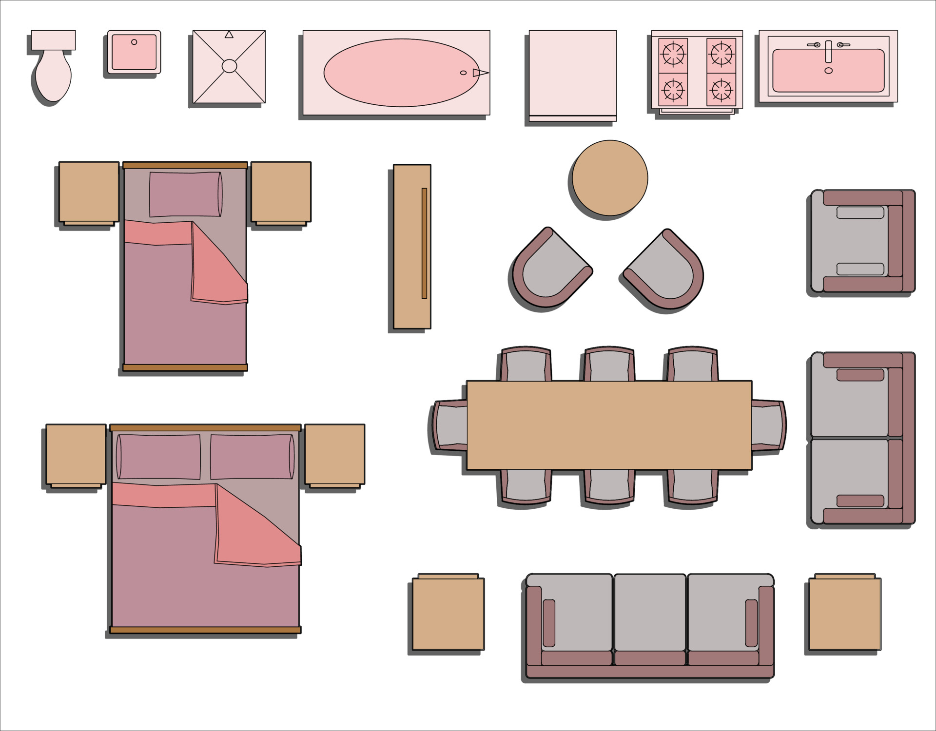
Interior & Floor Plans in 3D Vector Style
Elevate standard blueprints with our detailed vector illustrations of interiors—ideal for presentations, catalogs, and marketing.
Why Choose Us for 3D Vector Illustration?
Our approach combines design precision with aesthetic expertise. Each 3D vector map we create is designed to balance functionality and visual impact. Here’s why our clients trust us:
-
Vector Precision – This is especially important when creating large-format 3D map illustrations for exhibitions, billboards, or printed materials.
-
Customization & Flexibility – Each project is different, and so are our vector maps. We adapt to your style guides, color palettes, labeling needs, and file formats.
-
Fast Turnaround – We respect deadlines. From the initial draft to final delivery, we maintain high standards of communication and timely updates.
-
CAD & GIS Integration – We work directly with your CAD, GIS, and blueprint files, ensuring that your map illustrations are technically accurate and data-driven.
-
Presentation-Ready – All our 3D vector illustrations are designed to look great in both digital and print formats—perfect for client presentations, proposals, and promotional materials.
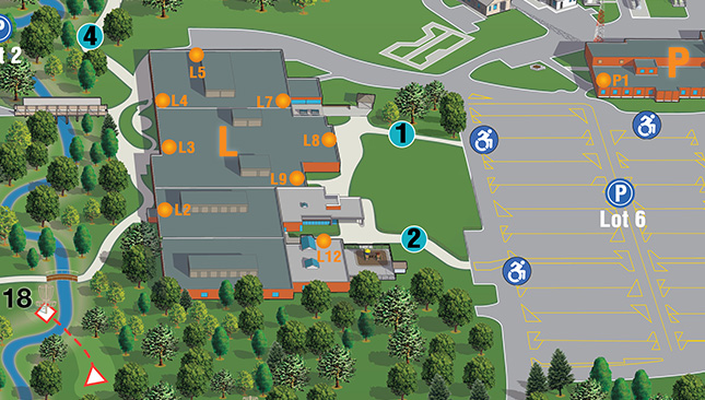
Who Benefits from Our 3D Map Illustration Services?
Our 3D vector map services serve a wide range of industries, including
Architects & Urban Planners
Real Estate Developers
Government & Municipalities
Landscape Architects
Infrastructure Engineers
Marketing Agencies
Environmental Planners
Whether you need a vector illustration for a presentation, public approval, or investor pitch, our visuals make an impact.
File Formats & Delivery
We deliver vector maps in your preferred format, including
AI (Adobe Illustrator)
SVG
EPS
DWG (AutoCAD)
JPEG/PNG (for previews and print)
All vector files are fully editable, layered, and scalable for any application
Want to see what we can do? Contact us for a sample or browse our case studies.
We have delivered hundreds of 3D map illustrations for clients worldwide. From smart cities to eco resorts, our portfolio reflects diverse styles, technical accuracy, and visual sophistication.
Our Process
Get Your Custom Vector Maps Today
No matter the scale of your project, we’re here to deliver high-quality, scalable vector illustrations that bring clarity and life to your architectural ideas. Start your project with confidence. Choose All Architecture Illustrations for high-quality, scalable, and customized vector maps that turn your ideas into compelling visual stories.
.jpg)