High-Impact Visuals for Real-World Results
At All Architecture Illustration, we specialize in delivering premium-quality photorealistic maps and architectural visualizations that help your ideas stand out. Whether you're an architect, planner, developer, or designer, our 3D photorealistic rendering services bring your concepts to life with stunning clarity and lifelike accuracy.
From site maps and master plans to large-scale developments and interiors, we craft photorealistic architectural renderings that not only look real, but feel real. With deep expertise in architecture, terrain modeling, and environment rendering, we ensure each visualization is both technically accurate and artistically impactful.
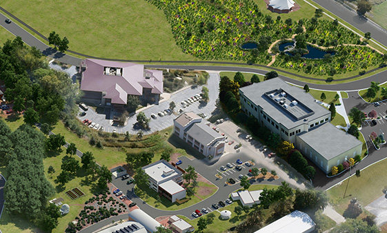
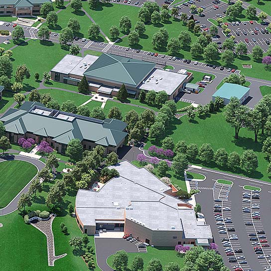
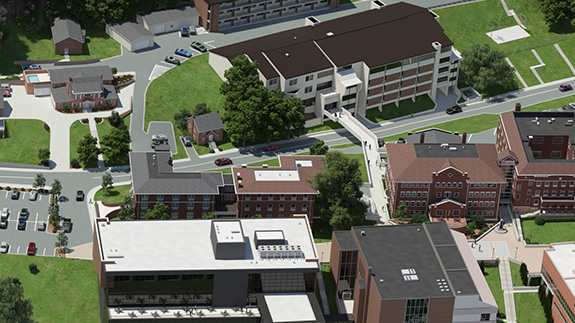
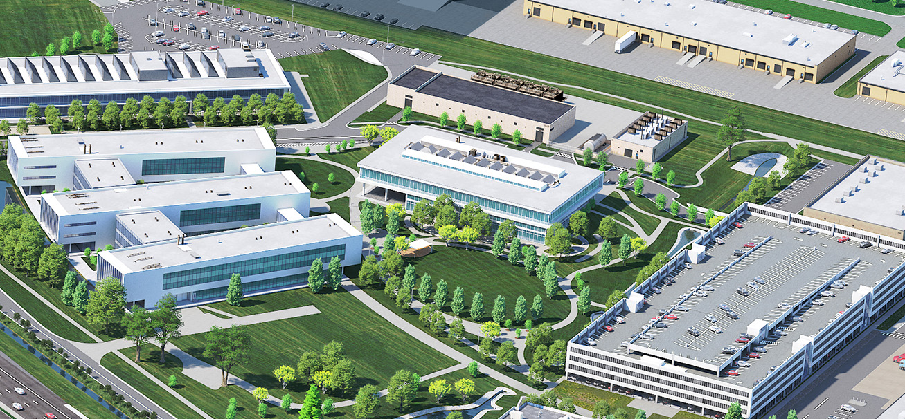
What Is a Photorealistic Map?
A map is more than just a diagram. These maps are created using advanced modeling and rendering tools to deliver realistic lighting, textures, shadows, and environmental elements.
Unlike traditional flat diagrams or schematic drawings, it allows viewers to understand the spatial relationship between structures, landscapes, and other site elements in a visually intuitive way. These renderings are ideal for architecture, urban planning, resort development, landscape design, and large-scale infrastructure projects.
At All Architecture Illustration, our maps help clients visualize everything from urban developments to resorts, commercial complexes, and landscaping projects—long before construction begins.
Why Choose All Architecture Illustration for 3D Photorealistic Rendering?
Here’s why clients choose our services time and time again
Photorealistic Precision
Our 3D photorealistic rendering process ensures your designs are translated into lifelike visual experiences, showcasing true-to-life materials, finishes, and perspectives. Lighting simulations and environmental context enhance realism and spatial understanding.
Architectural Expertise
As specialists in photorealistic architectural rendering, we understand how to represent your ideas the way professionals want to see them—accurate, clean, and compelling. We understand zoning constraints, site topography, and urban integration—all of which inform our visualizations.
Fast Turnaround
Need visuals under a deadline? We deliver high-quality maps and renderings quickly, without sacrificing detail or depth.
Tailored Visuals
Every project is custom-built, whether you need an aerial map, an interior space, or a complete exterior walkthrough.
Our Photorealistic Map Services
- Landscape & Terrain Rendering
- Master Plan Visualization in Photorealistic Style
- Resort & Golf Course Maps
- Commercial and Industrial Site Illustrations
- Bird’s-Eye and Street-Level Views
- Interior Renderings with Natural Lighting and Shadow Play
Photorealistic Architectural Rendering for residential, commercial, and mixed-use buildings
Our renderings are perfect for proposals, marketing, investor decks, public presentations, and stakeholder meetings.
.jpg)
Who We Work With
Architects –
Real Estate Developers –
City Planners –
Engineers –
Resort Designers –
Marketing Teams –
Golf Course Planners –
Construction Consultants –
From zoning boards to luxury property buyers, our visuals help everyone see your vision. Our collaborative approach ensures all stakeholders feel involved and informed during each phase.
Why Photorealistic Architectural Rendering Matters
Visual storytelling is essential in architecture. Here’s how.
Increases Approval Rates – Help city officials, clients, and investors visualize the result, making approval faster and easier.
Reduces Miscommunication – High-detail visuals make it easy to spot problems and resolve design conflicts early in the planning process.
Whether it’s a pre-construction pitch or a grand-scale masterplan, our photorealistic architectural renderings build trust and excitement.
How It Works – Our Process
Project Consultation – Share your plans, goals, and files (CAD, PDFs, sketches, etc.). We learn about your design intent, target audience, and communication objectives.
Concept & Data Review – We analyze your architectural drawings, topographical data, and references to begin the 3D modeling process.
Photorealistic Rendering – Our artists create a detailed photorealistic architectural rendering with real-world materials, lighting effects, and environmental settings.
Client Review & Feedback – We adjust lighting, camera angles, and materials as needed.
Final Delivery – We deliver your high-resolution map ready for print, web, or presentation use.
Each step is collaborative and transparent, ensuring your satisfaction and project success.
Deliverables & Formats
We provide all files in professional formats suited for your specific use case
High-resolution JPG / PNG
TIFF for print publications
PDF for presentations
MP4 animations (on request)
360° views and interactive maps (optional)
Ready to Start Your Next Visual Masterpiece?
At All Architecture Illustration, we believe that every space has a story, and we help you tell it through precise, immersive, and powerful visuals.
If you're ready to elevate your project with a custom map or 3D photorealistic rendering, we're here to help you impress, inspire, and deliver.